© Getty Images
January 2022
Delving into history with high tech
By
Volker Paulun
In the quest for traces of our ancestors, archeologists dig up Earth’s past – and increasingly avail themselves of pioneering technologies in the process.
-
Scanning the soil using Radar: We’ve seen it in documentaries: excavations are truly Sisyphean tasks. In most cases, heavy-duty equipment cannot be used due to the risk of damaging potentially hidden treasures. Consequently, small shovels serve to scrape finds or fine brushes to expose them. With a “ground-penetrating radar” (GPR) unit archaeologists are able to deeply penetrate soil but not only that: in 2018, researchers discovered an airplane that was lost in 1942 91 meters (298 feet) below Greenland ice using GPR on board of a drone. These small remote-controlled aerial vehicles are used by archaeologists increasingly often too. © Getty Images
-
Perfect imaging of finds: 3D scanners are less helpful in the quest for finds but do help in the subsequent analysis. The deeply penetrating systems, some of which can be used as portable ray guns at the excavation site, assist the scientists in examining and imaging the finds down to molecular level without touching them and potentially damaging them in the process. Not only CT scanners and X-rays are used for this purpose (see also page 14) but especially laser-based 3D scans costing only a fraction of a CT. © Getty Images
-
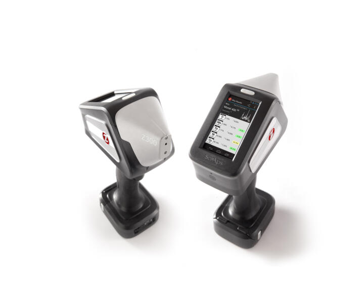
Geochemical soil analysis using lasers: Wherever humans settle they leave traces behind. Traces that can be detected in the soil even centuries later when all other remnants have long disappeared. State-of-the-art spectroscopy laser guns (LIBS) provide on-site geochemical soil analyses resulting in massive time savings. While a laboratory can perform 20 to 30 analyses per week, the on-site laser method enables hundreds to be performed per day. © Sciaps
-
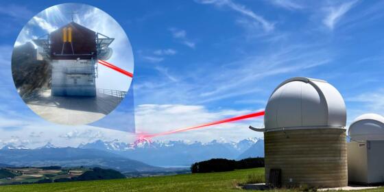
Peering underneath nature’s green cloak: In 2021, the popular “National Geographic” science magazine enthusiastically titled an article: Laser Scans Reveal Maya “Megalopolis” Below Guatemalan Jungle. Researchers had discovered the ruins of a network of interconnected cities that were home to millions of people using Lidar technology, which stands for “light detection and ranging” and is also known from autonomous vehicles using laser Radar to scan their surroundings. Archaeologists fly over densely forested areas using the deeply penetrating tech eyes in their quest for hidden treasures. The technology gathers millions of measured data points that a computer converts into detailed three-dimensional surface profiles (pictured left: original, pictured right: computer simulation). As early as in 2013, researchers had discovered an ancient megalopolis near the Cambodian temple complex with the help of Lidar technology. Lidar cameras have also used been used for years to fly over the rain forest surrounding the Inka citadel Machu Picchu repeatedly “exposing” new building structures in the process. © Ithaca College
-
Treasure hunting with Google Earth: Archaeologists used aerial photography long before the first satellites began to orbit Earth. But ever since Google Maps and other satellite imagery services have been offering views of Earth for everyone, professional and amateur archaeologists have been enjoying all-new opportunities to trace the past. American archaeologist Dr. Scott Madry, a Google Earth pioneer and mentor, provides an example from his practical experience to emphasize the potential of these aerial images: after looking for historic Roman sites in Burgundy, France, for 25 years using conventional methods and finding around 20 of them, he discovered more than 100 hundred on his computer at home using Google Earth.
Other interesting reads


